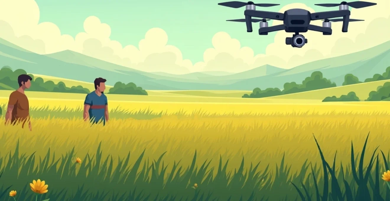
Drone technology is revolutionizing the agricultural sector, offering farmers unprecedented capabilities in crop management and monitoring. These unmanned aerial vehicles, equipped with advanced sensors and precision spraying systems, are transforming traditional farming practices into data-driven, efficient operations. By leveraging drones, farmers can now achieve levels of accuracy and insight that were previously unattainable, leading to improved crop yields, reduced chemical usage, and more sustainable farming practices.
The integration of drones into agriculture represents a significant leap forward in precision farming techniques. From detailed crop health assessments to targeted pesticide application, drones are providing farmers with the tools they need to make informed decisions and optimize their operations. This technological advancement is not just enhancing productivity; it’s reshaping the entire landscape of modern agriculture.
Precision agriculture revolution: Drone-Enabled crop management
Precision agriculture, empowered by drone technology, is fundamentally changing how farmers approach crop management. By utilizing drones, farmers can now gather highly accurate data about their fields, enabling them to make precise decisions about planting, irrigation, and harvest timing. This level of precision allows for the optimization of resources, resulting in improved crop yields and reduced environmental impact.
One of the key advantages of drone-enabled crop management is the ability to identify issues early. Drones equipped with high-resolution cameras and multispectral sensors can detect signs of pest infestations, disease outbreaks, or nutrient deficiencies before they become visible to the naked eye. This early detection capability allows farmers to take prompt, targeted action, potentially saving entire crops from devastation.
Moreover, drones facilitate the creation of detailed field maps, providing farmers with a comprehensive overview of their land. These maps can highlight variations in soil composition, moisture levels, and crop health across different areas of a field. Armed with this information, farmers can implement variable rate applications of fertilizers and pesticides, ensuring that each part of the field receives exactly what it needs – no more, no less.
Drone technology is not just an improvement on existing methods; it’s a complete paradigm shift in how we approach agriculture. It’s giving farmers the ability to see and understand their crops in ways they never could before.
Advanced sensor technologies in agricultural drones
The effectiveness of agricultural drones largely depends on the sophisticated sensor technologies they employ. These sensors are the eyes and ears of the drone, collecting vital data that forms the basis of informed decision-making in crop management. Let’s explore some of the most impactful sensor technologies currently being utilized in agricultural drones.
Multispectral imaging for crop health assessment
Multispectral imaging is a cornerstone technology in agricultural drones, providing invaluable insights into crop health. These sensors capture data across multiple bands of the electromagnetic spectrum, including visible light and near-infrared (NIR) wavelengths. By analyzing the reflectance patterns of crops in different spectral bands, farmers can assess plant vigor, chlorophyll content, and overall health with remarkable accuracy.
The data collected through multispectral imaging is often used to calculate vegetation indices such as the Normalized Difference Vegetation Index (NDVI) . NDVI values provide a quantitative measure of plant health, allowing farmers to identify areas of stress or poor growth within their fields. This information enables targeted interventions, optimizing resource allocation and potentially increasing yields.
Lidar systems for 3D terrain mapping
Light Detection and Ranging (LiDAR) technology is revolutionizing the way farmers understand and manage their land. LiDAR systems use laser pulses to measure distances and create highly detailed 3D maps of agricultural terrain. These maps provide precise information about field topography, including slopes, depressions, and other features that can affect drainage and irrigation.
The accuracy of LiDAR mapping allows farmers to implement more effective water management strategies, design optimal planting patterns, and even plan for future land improvements. Additionally, LiDAR data can be used to calculate plant height and canopy density, offering insights into crop growth rates and potential yield estimates.
Thermal cameras for water stress detection
Thermal imaging cameras mounted on drones have become powerful tools for detecting water stress in crops. These sensors measure the surface temperature of plants, which can indicate whether they are receiving adequate water. Plants under water stress tend to have higher surface temperatures as they reduce transpiration to conserve water.
By identifying areas of water stress early, farmers can adjust their irrigation strategies to ensure optimal water distribution across their fields. This not only helps to maintain crop health but also contributes to water conservation efforts, an increasingly important consideration in many agricultural regions facing water scarcity.
Hyperspectral sensors for nutrient deficiency identification
Hyperspectral sensors represent the cutting edge of crop monitoring technology. These advanced sensors can capture data across hundreds of narrow spectral bands, providing an incredibly detailed view of crop characteristics. This level of spectral resolution allows for the identification of specific nutrient deficiencies, pest infestations, and even early signs of disease.
For example, hyperspectral imaging can detect subtle changes in leaf pigmentation that may indicate a nitrogen deficiency before it becomes visually apparent. This early detection capability enables farmers to address nutritional issues promptly, potentially preventing yield losses and optimizing fertilizer use.
The integration of these advanced sensor technologies into agricultural drones is providing farmers with an unprecedented level of insight into their crops. It’s like giving them a superpower – the ability to see the invisible and predict the future of their harvests.
Drone-based spraying systems: enhancing efficiency and accuracy
Drone-based spraying systems are transforming the application of pesticides, herbicides, and fertilizers in agriculture. These systems offer a level of precision and efficiency that traditional ground-based or aerial spraying methods simply cannot match. By leveraging the maneuverability and advanced targeting capabilities of drones, farmers can significantly reduce chemical usage while improving the effectiveness of their applications.
Variable rate application (VRA) technology
Variable Rate Application (VRA) technology is a key feature of modern drone spraying systems. This technology allows for the adjustment of application rates in real-time based on pre-mapped field data or sensor inputs. By varying the amount of chemicals applied according to the specific needs of different areas within a field, VRA ensures that each plant receives the optimal amount of treatment.
The benefits of VRA are twofold: it reduces overall chemical usage by preventing over-application in areas that don’t require it, and it improves crop health by ensuring that problem areas receive adequate treatment. This precision not only leads to cost savings but also minimizes environmental impact by reducing chemical runoff.
Nozzle designs for optimal droplet size control
The effectiveness of any spraying operation is heavily dependent on droplet size. Drone-based systems incorporate advanced nozzle designs that allow for precise control over droplet size and distribution. This level of control is crucial for ensuring that the applied chemicals reach their intended targets and adhere properly to plant surfaces.
Different crops and chemicals require different optimal droplet sizes. For example, systemic pesticides may be more effective with larger droplets that are less prone to drift, while contact herbicides might require finer droplets for better coverage. The ability to adjust droplet size on-the-fly allows for tailored applications that maximize efficacy while minimizing waste and drift.
Gps-guided precision spraying patterns
GPS technology plays a crucial role in ensuring accurate and efficient spraying patterns. Drones equipped with high-precision GPS systems can follow pre-programmed flight paths with centimeter-level accuracy. This capability allows for the creation of optimized spraying patterns that ensure complete coverage of the target area without unnecessary overlap.
The precision of GPS-guided spraying also enables the implementation of spot-spraying techniques . By integrating data from multispectral or hyperspectral sensors, drones can identify specific areas within a field that require treatment and apply chemicals only to those areas. This targeted approach can lead to significant reductions in chemical usage, sometimes by as much as 50-80% compared to traditional blanket spraying methods.
Automated obstacle avoidance in complex terrains
One of the key advantages of drone-based spraying systems is their ability to navigate complex terrains and avoid obstacles automatically. Advanced drones are equipped with obstacle detection and avoidance systems that use a combination of visual sensors, ultrasonic sensors, and AI algorithms to navigate safely around trees, power lines, and other potential hazards.
This capability not only enhances safety but also allows for more efficient spraying in challenging environments. Drones can maintain optimal spraying height and accuracy even in areas with uneven terrain or obstructions, ensuring consistent coverage where traditional spraying methods might struggle.
The combination of these advanced features in drone-based spraying systems is leading to a paradigm shift in how farmers approach crop protection and nutrition. By enabling more precise, efficient, and targeted applications, these systems are helping to reduce chemical usage, minimize environmental impact, and improve overall crop health and yield.
Data analytics and AI integration in drone crop monitoring
The true power of drone technology in agriculture lies not just in the data collection capabilities, but in the advanced analytics and artificial intelligence (AI) systems that process and interpret this data. These sophisticated systems transform raw sensor data into actionable insights, enabling farmers to make informed decisions quickly and effectively.
Machine learning algorithms for pest detection
Machine learning algorithms are revolutionizing pest management in agriculture. By analyzing multispectral and hyperspectral imagery collected by drones, these algorithms can identify patterns and anomalies that indicate the presence of pests or diseases. The system learns from vast datasets of plant images, becoming increasingly accurate in detecting even subtle signs of infestation.
For example, a machine learning model might be trained to recognize the specific spectral signature of a crop infected with a particular fungus. As the drone surveys the field, the algorithm can quickly identify affected areas, allowing for targeted treatment before the infection spreads. This early detection capability can significantly reduce crop losses and minimize the need for broad-spectrum pesticide applications.
Predictive modeling for yield estimation
Predictive modeling techniques are being applied to drone-collected data to provide accurate yield estimations well before harvest time. These models integrate various data points, including plant health indices, historical yield data, weather patterns, and soil conditions, to forecast crop yields with remarkable accuracy.
By providing early yield estimates, these predictive models allow farmers to make informed decisions about resource allocation, harvesting logistics, and even marketing strategies. For instance, if a lower-than-expected yield is predicted, a farmer might adjust their irrigation or fertilization practices to try to improve outcomes, or they might begin early negotiations with buyers to manage expectations.
Cloud-based data processing and storage solutions
The vast amounts of data collected by agricultural drones require robust processing and storage solutions. Cloud-based platforms have emerged as the go-to solution, offering scalable computing power and storage capacity that can handle the complex analytics required for modern precision agriculture.
These cloud platforms not only process and store data but often provide user-friendly interfaces that allow farmers to access insights and generate reports easily. Many of these systems offer integration with farm management software, creating a comprehensive digital ecosystem for agricultural operations.
Moreover, cloud-based solutions facilitate data sharing and collaboration. Farmers can easily share data with agronomists, researchers, or other experts for additional analysis or advice. This connectivity is fostering a new era of collaborative agriculture, where insights and best practices can be shared across the industry.
Real-time crop health alerts and notifications
The integration of AI and real-time data processing enables the development of alert systems that can notify farmers of potential issues as soon as they are detected. These systems continuously analyze incoming drone data, comparing it against established baselines and known problem indicators.
When anomalies are detected – such as a sudden change in crop health in a specific area or the early signs of a pest infestation – the system can immediately alert the farmer via smartphone notifications or email. This real-time alerting capability allows for rapid response to emerging issues, potentially preventing small problems from becoming major crop losses.
The combination of drone technology with advanced data analytics and AI is not just improving farming; it’s redefining what’s possible in agriculture. We’re moving towards a future where farms are managed with unprecedented precision and foresight.
Regulatory landscape and compliance for agricultural drones
As the adoption of drone technology in agriculture continues to grow, navigating the regulatory landscape becomes increasingly important for farmers and drone operators. Regulations surrounding the use of drones in agriculture are designed to ensure safety, protect privacy, and manage airspace. However, these regulations can vary significantly between countries and even between different regions within a country.
In many jurisdictions, agricultural drone operations fall under specific categories within broader drone regulations. For example, in the United States, the Federal Aviation Administration (FAA) has established rules for commercial drone use, including agricultural applications. These rules cover aspects such as pilot certification, drone registration, and operational limitations.
Key regulatory considerations for agricultural drone use often include:
- Pilot certification requirements
- Drone registration and identification
- Flight altitude and visibility restrictions
- Operational area limitations (e.g., distance from airports)
- Privacy and data protection regulations
Compliance with these regulations is crucial not only for legal reasons but also for ensuring the safe and responsible use of drone technology in agriculture. Many countries are continually updating their drone regulations to keep pace with technological advancements and to address emerging concerns.
For agricultural drone operations involving spraying, additional regulations often apply. These may include restrictions on the types of chemicals that can be applied by drone, requirements for drift management, and specific training or certification for operators of spraying drones. In some regions, there may also be requirements for notifying nearby residents or obtaining permits before conducting aerial spraying operations.
As the regulatory landscape evolves, it’s essential for farmers and drone operators to stay informed about current regulations and any upcoming changes. Many agricultural drone manufacturers and service providers offer support in navigating regulatory requirements, and industry associations can be valuable sources of information and advocacy.
Economic impact and ROI analysis of drone technology in farming
The adoption of drone technology in agriculture represents a significant investment for farmers, but one that can offer substantial returns. To understand the economic impact of agricultural drones, it’s important to consider both the direct cost savings and the potential for increased revenue through improved crop yields and quality.
Direct cost savings from drone technology often come from reduced input costs. Precision application of fertilizers and pesticides can lead to significant reductions in chemical usage, sometimes by 20-30% or more. This not only reduces the cost of inputs but also minimizes environmental impact. Additionally, the efficiency of drone operations can lead to labor cost savings, particularly for tasks like crop scouting and spraying.
On the revenue side, the improved crop management enabled by drone technology can lead to higher yields and better crop quality. Early detection of issues like pest infestations or nutrient deficiencies allows for timely interventions that can save crops that might otherwise be lost. Some farmers report yield increases of 10-15% after implementing drone-based precision agriculture techniques.
To illustrate the potential ROI of agricultural drone technology, consider the following simplified example:
| Factor | Without Drones | With Drones |
|---|---|---|
| Chemical Costs | $50,000 | $37,500 (25% reduction) |
| Labor Costs | $30,000 | $24,000 (20% reduction) |
| Crop Yield | $200,000 | $220,000 (10% increase) |
| Total | $120,000 (profit) | $158,500 (profit) |
In this example, the use of drone technology results in a profit increase of $38,500. Assuming an initial investment of $50,000 in drone technology and associated training, the ROI period would be less than two years. It’s important to note that actual results can vary significantly based on factors such as farm size, crop type, and specific implementation of the technology.
Beyond the quantifiable economic benefits,
the use of drone technology can lead to several intangible benefits that contribute to long-term farm sustainability and profitability:
- Improved decision-making through data-driven insights
- Reduced environmental impact and improved sustainability credentials
- Enhanced farm management efficiency and reduced stress for farmers
- Potential for premium pricing for crops grown using precision agriculture techniques
As drone technology continues to evolve and become more affordable, its economic impact on agriculture is likely to grow. Ongoing advancements in sensor technology, AI-driven analytics, and automation are expected to further enhance the ROI potential of agricultural drones in the coming years.
The economic benefits of drone technology in agriculture extend far beyond immediate cost savings. It’s about creating a more resilient, sustainable, and profitable farming model for the future.
In conclusion, the benefits of using drone technology for crop spraying and monitoring are multifaceted and significant. From enhancing precision in agriculture to providing advanced sensor capabilities, improving spraying efficiency, and enabling data-driven decision making, drones are revolutionizing farming practices. As regulatory frameworks continue to evolve and the economic benefits become increasingly clear, the adoption of drone technology in agriculture is likely to accelerate, paving the way for a more efficient, sustainable, and productive farming future.