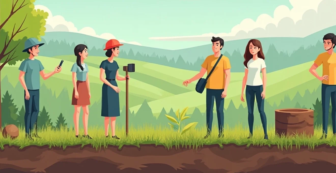
Soil science education plays a crucial role in developing future environmental stewards and agricultural experts. However, traditional classroom-based learning often fails to capture the complexity and dynamism of soil systems. To truly engage students and foster a deep understanding of soil science, hands-on fieldwork is essential. By bringing students out of the classroom and into direct contact with soil profiles, educators can ignite curiosity, develop practical skills, and demonstrate the real-world applications of soil science concepts.
Fieldwork not only enhances student engagement but also provides invaluable experiential learning opportunities. When students physically interact with soil, they develop a tactile understanding of soil properties, witness soil formation processes firsthand, and gain practical skills that are essential for future careers in soil science, agriculture, and environmental management. This approach to teaching soil science bridges the gap between theory and practice, creating a more holistic and memorable educational experience.
Soil profile analysis techniques for Field-Based learning
Soil profile analysis is a fundamental skill in soil science, and field-based learning provides the perfect opportunity to develop this expertise. By teaching students to examine soil profiles in situ, educators can help them understand the complex interplay of factors that contribute to soil formation and characteristics. Here are some key techniques to incorporate into field-based soil profile analysis:
- Visual assessment of soil horizons
- Texture determination using the feel method
- Color identification using Munsell soil color charts
- Structure and consistency evaluation
- Root distribution and biological activity observation
When conducting soil profile analysis in the field, it’s crucial to emphasise safety and proper sampling techniques. Teach students to use appropriate tools such as soil augers, profile samplers, and field pH meters. Encourage them to record their observations systematically, using field notebooks or digital data collection tools.
To enhance the learning experience, consider incorporating comparative analysis of different soil profiles within the same area. This approach allows students to observe how factors like topography, vegetation, and land use can influence soil development. You might ask students to hypothesise about the reasons for differences they observe between profiles, promoting critical thinking and analysis skills.
Integrating geospatial technologies in soil science education
The integration of geospatial technologies has revolutionised soil science research and practice. By incorporating these tools into soil science education, instructors can provide students with valuable skills that are highly sought after in the industry. Geospatial technologies offer powerful ways to collect, analyse, and visualise soil data, enhancing students’ understanding of spatial relationships in soil systems.
Using GPS for precise soil sampling locations
Global Positioning System (GPS) technology is an essential tool for modern soil scientists. Teaching students to use GPS for recording precise sampling locations ensures that their field data is georeferenced, allowing for accurate mapping and future reference. Introduce students to handheld GPS devices or smartphone apps designed for field use, and demonstrate how to record waypoints and tracks during soil sampling expeditions.
Encourage students to create sampling grids using GPS coordinates, which can be used for systematic soil surveys. This approach helps students understand the importance of spatial representation in soil sampling and how it affects the interpretation of results. You might assign a project where students design and implement a soil sampling strategy for a given area, using GPS to ensure consistent and replicable data collection.
Implementing GIS for spatial soil data visualization
Geographic Information Systems (GIS) are powerful tools for analysing and visualising spatial soil data. Introducing students to GIS software like QGIS or ArcGIS can significantly enhance their ability to interpret and present soil information. Start with basic tasks such as importing GPS data, creating soil maps, and overlaying different data layers (e.g., topography, land use, geology) to explore relationships between soil properties and environmental factors.
As students become more proficient, introduce more advanced GIS techniques such as interpolation methods for creating continuous soil property maps from point data. This could include techniques like kriging or inverse distance weighting. Encourage students to think critically about the strengths and limitations of different spatial analysis methods and how they might affect interpretation of soil data.
Drone-based remote sensing for soil mapping projects
Drone technology has opened up new possibilities for high-resolution soil mapping and monitoring. Incorporating drone-based remote sensing into soil science education can provide students with cutting-edge skills and a unique perspective on soil variability across landscapes. Begin by teaching students about the principles of remote sensing and the types of sensors commonly used for soil analysis, such as multispectral and thermal cameras.
Organise field sessions where students can plan and execute drone flights for soil mapping purposes. This might include creating orthomosaic maps, generating digital elevation models, or using vegetation indices to infer soil properties. Discuss the regulatory aspects of drone use and emphasise the importance of following local laws and obtaining necessary permissions.
Mobile apps for Real-Time soil data collection
Mobile applications have transformed field data collection, making it more efficient and reducing the risk of transcription errors. Introduce students to mobile apps designed for soil science fieldwork, such as SoilWeb or SoilInfo. These apps often integrate GPS functionality and can provide instant access to soil survey databases, making them valuable tools for field-based learning.
Encourage students to develop their own data collection forms using platforms like ODK Collect or Kobo Toolbox. This exercise not only teaches them about data structure and management but also allows them to customise their data collection to specific research questions. By using these apps, students can seamlessly integrate their field observations with other geospatial data, facilitating more comprehensive analysis and interpretation.
Hands-on soil chemistry experiments for student engagement
Soil chemistry is a fundamental aspect of soil science that can be challenging to teach without practical, hands-on experiences. By incorporating field-based soil chemistry experiments, educators can make abstract concepts tangible and demonstrate the real-world implications of soil chemical properties. These experiments not only enhance student engagement but also develop critical analytical skills.
Ph and electrical conductivity measurements in the field
Measuring soil pH and electrical conductivity (EC) in the field provides immediate insights into soil chemical properties and their spatial variability. Equip students with portable pH meters and EC probes, and teach them proper calibration and measurement techniques. Encourage them to take multiple readings across a study area and to consider factors that might influence these properties, such as topography, vegetation, and land use history.
To deepen understanding, have students compare field measurements with laboratory analysis of collected samples. This comparison can lead to discussions about the advantages and limitations of field versus laboratory methods, and the importance of quality control in scientific data collection.
Soil organic matter determination using Loss-on-Ignition method
The loss-on-ignition (LOI) method is a simple yet effective technique for estimating soil organic matter content. While the final ignition step requires laboratory facilities, the initial sample collection and preparation can be conducted in the field. Teach students proper sampling techniques for organic matter analysis, including the importance of avoiding contamination and recording accurate sample depths.
In the field, students can learn to recognise visual indicators of high organic matter content, such as dark soil colors and the presence of organic horizons. This observational skill can then be correlated with the quantitative results from the LOI method, reinforcing the connection between field observations and analytical data.
Cation exchange capacity assessment techniques
Cation exchange capacity (CEC) is a crucial soil property that influences nutrient retention and availability. While precise CEC determination typically requires laboratory analysis, field techniques can provide estimates and demonstrate the concept. One such method is the ammonium acetate extraction, which can be adapted for field use with some modifications.
Introduce students to the principles of cation exchange and its importance in soil fertility. In the field, demonstrate how soil texture, organic matter content, and clay mineralogy can influence CEC. Use simple field tests, such as the ribbon test for soil texture, to help students make connections between observable soil properties and CEC.
Soil nutrient analysis using colorimetric test kits
Colorimetric test kits offer a rapid, field-friendly method for assessing key soil nutrients such as nitrogen, phosphorus, and potassium. While not as precise as laboratory methods, these kits provide immediate results that can be valuable for educational purposes. Teach students how to properly collect and prepare soil samples for nutrient analysis, emphasising the importance of representative sampling.
Organise a field exercise where students use test kits to analyse nutrient levels across different land use types or along environmental gradients. This activity can lead to discussions about nutrient cycling, the effects of fertilisation practices, and the relationship between soil nutrients and vegetation patterns.
Hands-on soil chemistry experiments in the field not only enhance student engagement but also develop critical analytical skills essential for future soil scientists and environmental professionals.
Practical soil physics demonstrations for experiential learning
Soil physics concepts can often seem abstract when taught solely in the classroom. Field-based demonstrations and experiments bring these concepts to life, allowing students to observe and measure soil physical properties directly. Here are some practical soil physics demonstrations that can be incorporated into field-based learning:
- Bulk density measurement using the core method
- Infiltration rate assessment with infiltrometers
- Soil water content determination using time-domain reflectometry (TDR)
- Soil strength evaluation with a penetrometer
- Aggregate stability testing using the wet sieving method
When conducting these demonstrations, encourage students to think critically about how soil physical properties influence water movement, root growth, and soil management practices. For example, after measuring infiltration rates, discuss how this information might be used in irrigation planning or flood risk assessment.
Consider incorporating a comparative element into these demonstrations. For instance, have students measure bulk density in areas with different levels of compaction, such as a well-trodden path versus an undisturbed area. This approach helps students understand the impact of human activities on soil physical properties and the potential consequences for soil function and plant growth.
Incorporating soil microbiology into Field-Based curricula
Soil microbiology is a fascinating and critical aspect of soil science that can greatly benefit from field-based learning approaches. By incorporating soil microbiology into fieldwork, educators can help students understand the complex interactions between soil microorganisms and their environment, as well as the crucial role these organisms play in ecosystem functioning.
In-situ soil respiration measurements
Soil respiration is a key indicator of microbial activity and soil health. Teaching students to measure soil respiration in the field provides insights into carbon cycling and microbial metabolism. Introduce students to portable soil respiration systems or simple chamber methods for measuring CO2 flux from the soil surface.
Organise field experiments where students compare soil respiration rates across different ecosystems or land use types. This can lead to discussions about factors influencing microbial activity, such as temperature, moisture, and substrate availability. Encourage students to consider how soil management practices might affect soil respiration and, by extension, soil carbon dynamics.
Soil microarthropod sampling and identification
Soil microarthropods, such as mites and springtails, are important indicators of soil biodiversity and ecosystem health. Teaching students to sample and identify these organisms can provide valuable insights into soil food webs and decomposition processes. Demonstrate techniques like Berlese funnel extraction or pitfall trapping for collecting soil microarthropods.
In the field, have students compare microarthropod communities across different microhabitats or soil types. This activity can be linked to discussions about soil structure, organic matter content, and the role of soil fauna in nutrient cycling. Introduce students to basic taxonomic keys and encourage them to practice identifying common microarthropod groups.
Mycorrhizal fungi observation techniques
Mycorrhizal fungi play a crucial role in plant nutrition and soil structure formation. While detailed study of mycorrhizae often requires laboratory techniques, field observations can provide valuable learning opportunities. Teach students to recognise signs of mycorrhizal associations, such as fungal hyphae on plant roots or the presence of fruiting bodies.
Organise field sessions where students collect root samples and use portable microscopes or hand lenses to observe mycorrhizal structures. This can be combined with discussions about plant-soil interactions, nutrient cycling, and the importance of mycorrhizae in ecosystem restoration and sustainable agriculture.
Soil enzyme activity assays in field conditions
Soil enzyme activities are indicators of microbial function and nutrient cycling processes. While many enzyme assays are typically performed in the laboratory, some can be adapted for field use. Introduce students to simple colorimetric assays for enzymes such as β-glucosidase or phosphatase , which can be performed with portable spectrophotometers or even smartphone-based colorimeters.
Design field experiments where students measure enzyme activities across different soil depths or land use types. This can lead to discussions about the distribution of microbial communities in the soil profile, the effects of management practices on soil biological activity, and the relationship between enzyme activities and nutrient availability.
Designing collaborative soil conservation projects for students
Collaborative soil conservation projects provide an excellent opportunity for students to apply their knowledge to real-world challenges while developing teamwork and project management skills. These projects can be designed to address local soil conservation issues, engaging students with their community and demonstrating the practical importance of soil science.
Start by identifying local soil conservation challenges, such as erosion, compaction, or contamination. Partner with local farmers, conservation organisations, or government agencies to ensure the projects address genuine needs and have the potential for real impact. Divide students into teams and assign each team a specific conservation challenge to address.
Guide students through the process of developing a conservation plan, including site assessment, problem analysis, and the design of intervention strategies. Encourage them to integrate various aspects of soil science, from physical and chemical properties to microbial ecology, in their approach. This holistic perspective will reinforce the interconnected nature of soil systems and the need for multidisciplinary solutions in soil conservation.
Throughout the project, provide opportunities for teams to share their progress, challenges, and insights. This peer-to-peer learning can be facilitated through regular presentations, field visits to each team’s project site, or collaborative problem-solving sessions. At the conclusion of the projects, organise a symposium where teams present their findings and recommendations to stakeholders, reinforcing the real-world relevance of their work.
Collaborative soil conservation projects not only enhance students’ understanding of soil science but also develop crucial skills in problem-solving, communication, and project management that are essential for future careers in environmental science and management.
By incorporating these hands-on, field-based approaches into soil science education, you can create a dynamic and engaging learning environment that prepares students for the complexities of real-world soil management and conservation. These methods not only deepen students’ understanding of soil science concepts but also foster a sense of connection to the soil and its vital role in ecosystems and human society.