Precision agriculture is undergoing a transformative revolution, with drone technology at the forefront of this change. As farmers face increasing pressure to optimise yields while minimising environmental impact, drones offer unprecedented capabilities for data collection, analysis, and targeted interventions. This cutting-edge technology is reshaping how we approach crop management, resource allocation, and overall farm efficiency.
From multispectral imaging that reveals hidden crop health issues to precision spraying systems that reduce chemical usage, drones are providing farmers with tools to make more informed decisions. The integration of artificial intelligence and machine learning further enhances the power of drone-collected data, offering insights that were previously unattainable. As we delve into the world of agricultural drones, we’ll explore how this technology is not just changing farming practices, but potentially securing a more sustainable and productive future for global agriculture.
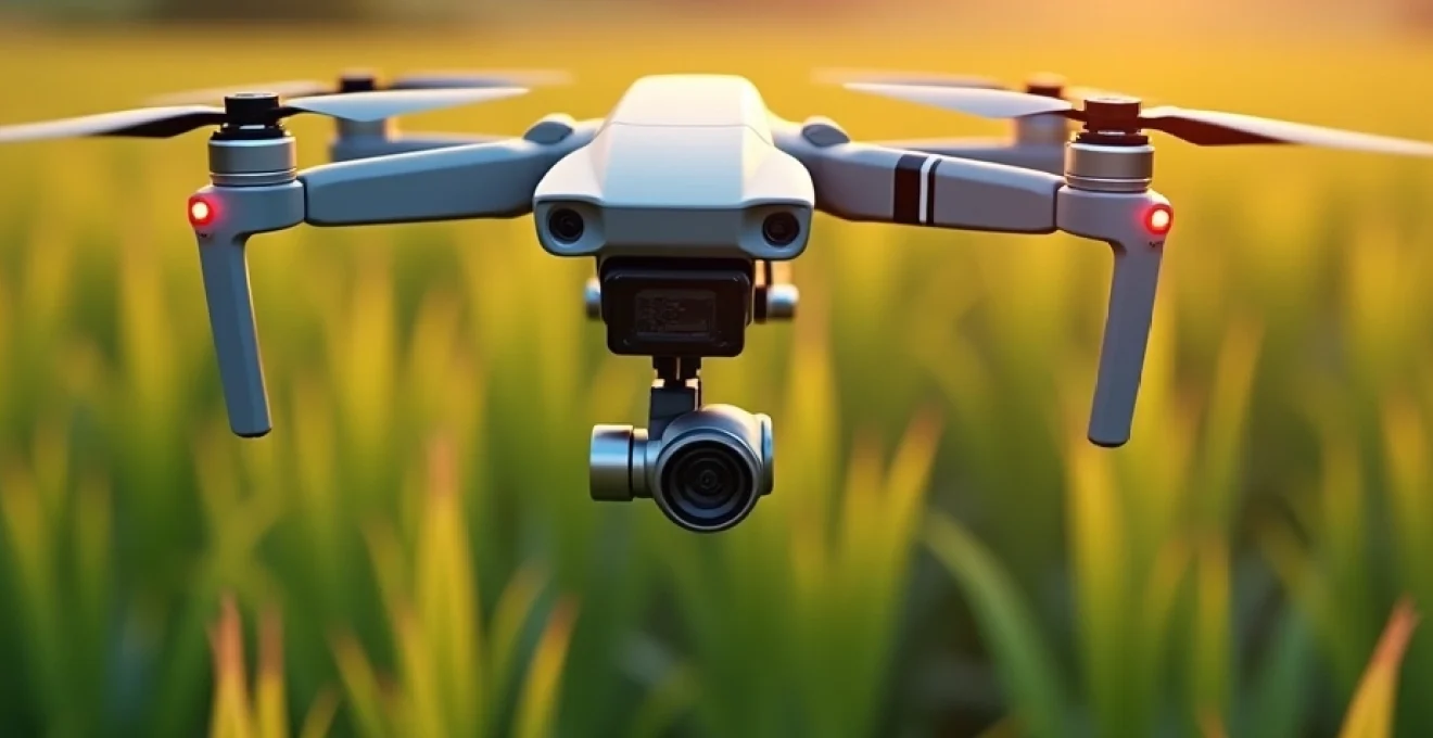
Drone technology in agricultural remote sensing
Agricultural remote sensing has been revolutionised by the advent of drone technology. These unmanned aerial vehicles (UAVs) offer farmers a bird’s-eye view of their fields with unprecedented detail and frequency. Unlike satellite imagery, which may be hindered by cloud cover or limited by infrequent passes, drones can be deployed on-demand, providing real-time data crucial for timely decision-making.
The flexibility of drone platforms allows for the integration of various sensors, each tailored to capture specific types of data. From high-resolution RGB cameras for visual inspection to more sophisticated multispectral and thermal sensors, drones can collect a wealth of information about crop health, soil conditions, and environmental factors. This data, when properly analysed, enables farmers to identify issues such as pest infestations, nutrient deficiencies, or irrigation problems far earlier than traditional scouting methods would allow.
Moreover, the ability of drones to fly at low altitudes results in higher resolution imagery compared to satellite or manned aircraft surveys. This level of detail is particularly valuable for precision agriculture, where centimetre-level accuracy can make a significant difference in optimising inputs and maximising yields. As drone technology continues to advance, we’re seeing longer flight times, improved sensor capabilities, and more sophisticated data processing algorithms, all of which are expanding the potential applications of UAVs in agriculture.
Multispectral and hyperspectral imaging for crop health analysis
Multispectral and hyperspectral imaging technologies have emerged as powerful tools in the arsenal of precision agriculture. These advanced sensing methods allow farmers to see beyond what the naked eye can perceive, revealing crucial information about crop health and vitality. By capturing data across multiple bands of the electromagnetic spectrum, these imaging techniques provide insights into plant stress, nutrient content, and overall crop vigour.
Multispectral sensors typically capture data in 4-10 spectral bands, including visible light and near-infrared (NIR) wavelengths. This data is particularly useful for calculating vegetation indices such as the Normalized Difference Vegetation Index (NDVI), which provides a quantitative measure of plant health. Hyperspectral sensors, on the other hand, can capture hundreds of narrow spectral bands, offering even more detailed information about crop biochemistry and physiology.
NDVI (normalized difference vegetation index) mapping with DJI phantom 4 multispectral
The DJI Phantom 4 Multispectral is a game-changer in the realm of NDVI mapping. This advanced drone combines the ease of use of the popular Phantom series with a sophisticated multispectral imaging system. Equipped with six sensors—one RGB camera and five monochrome sensors that capture data in the blue, green, red, red edge, and near-infrared spectral bands—the Phantom 4 Multispectral enables precise NDVI calculations.
NDVI mapping with this drone allows farmers to quickly assess crop health across their fields. The index provides a numerical value between -1 and 1, with higher values indicating healthier vegetation. By analysing NDVI maps, farmers can identify areas of stress, track crop growth over time, and make informed decisions about irrigation, fertilisation, and pest management. The real-time capabilities of the Phantom 4 Multispectral mean that issues can be spotted and addressed promptly, potentially saving crops before visible symptoms appear.
Thermal imaging for water stress detection using FLIR vue pro R
Water stress is a critical issue in agriculture, often invisible to the naked eye until significant damage has occurred. The FLIR Vue Pro R thermal camera, when mounted on a drone, provides farmers with a powerful tool for early detection of water stress in crops. This advanced thermal sensor can measure surface temperatures across an entire field, revealing areas where plants are struggling to regulate their temperature due to lack of water.
Thermal imaging works on the principle that water-stressed plants have reduced transpiration, leading to higher leaf temperatures. The FLIR Vue Pro R can detect these subtle temperature differences, creating thermal maps that highlight areas of potential water stress. This information allows farmers to optimise irrigation schedules, targeting water application to areas that need it most. By addressing water stress early, farmers can prevent yield loss and improve overall water use efficiency, a crucial factor in sustainable agriculture.
Hyperspectral sensors: headwall Nano-Hyperspec for disease detection
The Headwall Nano-Hyperspec represents the cutting edge of hyperspectral imaging technology for agricultural applications. This compact sensor can capture data across hundreds of spectral bands, providing an unprecedented level of detail about crop health and composition. The power of hyperspectral imaging lies in its ability to detect subtle changes in plant biochemistry that may indicate the onset of disease, even before visible symptoms appear.
By analysing the unique spectral signatures of plants, the Nano-Hyperspec can identify early signs of various crop diseases. This early detection capability is crucial for effective disease management, allowing farmers to take targeted action before an infection spreads. Moreover, the detailed spectral data can help distinguish between different types of stress, such as nutrient deficiencies or pest infestations, enabling more precise and effective interventions.
Lidar integration: velodyne puck for 3D crop modelling
LiDAR (Light Detection and Ranging) technology is revolutionising the way we model and understand crop structure. The Velodyne Puck, a compact and lightweight LiDAR sensor, can be easily integrated into drone systems to create highly accurate 3D models of agricultural landscapes. This technology uses laser pulses to measure distances to objects, creating point clouds that represent the physical structure of crops and the surrounding environment.
3D crop modelling with LiDAR offers several advantages for precision agriculture. It allows farmers to accurately measure crop height, density, and canopy structure, providing insights into plant growth and potential yield. This data can be used to optimise planting patterns, assess the effectiveness of different crop varieties, and even predict harvest timing. Additionally, LiDAR data can be used to create detailed digital elevation models, which are valuable for planning drainage systems and managing water flow across fields.
Precision spraying and variable rate application
Precision spraying and variable rate application (VRA) represent a significant leap forward in agricultural efficiency and environmental stewardship. These technologies leverage the data collected by drones and other precision agriculture tools to apply inputs—such as fertilisers, pesticides, and water—exactly where they are needed and in the precise amounts required. This targeted approach not only reduces waste and costs but also minimises the environmental impact of agricultural chemicals.
The key to effective precision spraying and VRA lies in creating detailed prescription maps. These maps are generated by analysing data from multispectral imagery, soil sensors, and historical yield data to determine the specific needs of different areas within a field. Advanced algorithms then use this information to control the application rate of inputs in real-time as equipment moves across the field.
DJI agras T30 for targeted pesticide application
The DJI Agras T30 is a cutting-edge agricultural drone designed specifically for precision spraying applications. With a 30-litre spray tank and a spraying width of up to 9 metres, this drone can cover large areas quickly and efficiently. What sets the Agras T30 apart is its intelligent spraying system, which adjusts the spray rate based on the drone’s flight speed and height, ensuring uniform coverage.
Equipped with advanced obstacle avoidance systems and RTK positioning, the Agras T30 can navigate complex field environments with centimetre-level accuracy. This precision allows for highly targeted pesticide application, reducing overall chemical usage while maximising effectiveness. The drone’s ability to access hard-to-reach areas or operate in conditions unsuitable for traditional ground-based equipment makes it a valuable tool for managing pest outbreaks quickly and efficiently.
Yamaha RMAX for Large-Scale fertiliser distribution
The Yamaha RMAX, a larger unmanned helicopter, takes precision application to an even grander scale. Originally developed for rice field spraying in Japan, the RMAX has found applications in various crops worldwide. With a payload capacity of up to 28 kg, this robust platform is particularly well-suited for large-scale fertiliser distribution.
The RMAX’s precision comes from its advanced GPS guidance system and variable rate technology. It can follow pre-programmed flight paths with high accuracy, adjusting fertiliser application rates based on prescription maps. This level of control ensures that each area of the field receives the optimal amount of nutrients, reducing waste and potential environmental impacts from over-application. The RMAX’s ability to cover large areas quickly makes it an efficient solution for time-sensitive fertiliser applications, particularly in challenging terrain where ground-based equipment might struggle.
Micasense RedEdge-MX for nutrient deficiency mapping
The Micasense RedEdge-MX is a sophisticated multispectral camera that plays a crucial role in creating detailed nutrient deficiency maps. This compact sensor captures five spectral bands—blue, green, red, red edge, and near-infrared—providing a comprehensive view of crop health and nutrient status. The inclusion of the red edge band is particularly valuable for detecting subtle changes in chlorophyll content, which can indicate nutrient stress before visible symptoms appear.
By analysing the data from the RedEdge-MX, farmers can create high-resolution maps that highlight areas of potential nutrient deficiencies across their fields. These maps can then be used to guide variable rate fertiliser applications, ensuring that nutrients are applied only where needed and in the appropriate amounts. This targeted approach not only optimises fertiliser use but also helps prevent issues such as nutrient runoff, which can have negative environmental impacts.
AI and machine learning in drone-based agriculture
The integration of Artificial Intelligence (AI) and Machine Learning (ML) with drone technology is ushering in a new era of data-driven decision-making in agriculture. These advanced computational techniques can process and analyse the vast amounts of data collected by drones, extracting actionable insights that would be impossible for humans to discern manually. AI and ML algorithms can identify patterns, predict outcomes, and even make autonomous decisions, dramatically enhancing the value of drone-collected data.
One of the most significant advantages of AI in drone-based agriculture is its ability to improve over time. As these systems process more data, they become increasingly accurate in their analysis and predictions. This continuous learning process means that AI-powered agricultural systems can adapt to new challenges, such as emerging pests or changing climate conditions, more quickly and effectively than traditional methods.
Tensorflow implementation for weed detection algorithms
TensorFlow, an open-source machine learning platform, has become a powerful tool for developing sophisticated weed detection algorithms in precision agriculture. By training deep learning models on large datasets of drone-captured images, researchers and agronomists can create highly accurate systems for identifying and mapping weed infestations across agricultural fields.
These TensorFlow-based algorithms can distinguish between crop plants and various weed species, even at early growth stages when visual differences are subtle. The convolutional neural networks (CNNs) used in these models can analyse multispectral imagery, detecting spectral signatures that indicate the presence of weeds. This capability enables the creation of detailed weed maps, which can guide targeted herbicide applications or mechanical weeding operations, significantly reducing chemical use and improving overall weed management efficiency.
Agisoft metashape for orthomosaic generation and analysis
Agisoft Metashape is a professional photogrammetry software that plays a crucial role in processing drone-captured imagery for agricultural applications. This powerful tool can generate highly accurate orthomosaic maps and 3D models from overlapping drone photos, providing a comprehensive view of entire fields or farms.
The orthomosaic maps created by Metashape are geometrically corrected and stitched together to form a single, high-resolution image of the entire surveyed area. These maps serve as the foundation for various analyses, including crop health assessment, yield estimation, and precision application planning. Metashape’s advanced algorithms can also generate digital elevation models (DEMs) and calculate vegetation indices like NDVI directly from the processed imagery, streamlining the workflow from data collection to actionable insights.
IBM watson IoT platform for real-time crop data processing
The IBM Watson IoT Platform brings the power of cloud computing and advanced analytics to drone-based agriculture. This comprehensive platform can ingest, process, and analyse real-time data from drones and other IoT devices deployed across agricultural operations. By leveraging Watson’s cognitive capabilities, farmers can gain unprecedented insights into their crops and make data-driven decisions with greater speed and accuracy.
One of the key advantages of the Watson IoT Platform is its ability to integrate data from multiple sources, including drone imagery, weather stations, soil sensors, and historical records. This holistic approach allows for more nuanced and context-aware analysis. For example, the platform can correlate drone-captured multispectral data with local weather patterns and soil moisture readings to provide highly accurate predictions of crop stress or disease risk. The real-time processing capabilities of Watson enable rapid response to emerging issues, potentially preventing crop losses and optimising resource use across the farm.
Regulatory framework and compliance for agricultural drones
As the use of drones in agriculture continues to expand, navigating the complex landscape of regulations and compliance has become increasingly important. Regulatory frameworks for drone operations vary significantly across different countries and regions, with rules governing aspects such as flight altitude, distance from populated areas, and pilot certification. For farmers and agricultural service providers, understanding and adhering to these regulations is crucial not only for legal compliance but also for ensuring safe and responsible drone use.
In many jurisdictions, commercial drone operations, including those for agricultural purposes, require specific licenses or certifications. Operators may need to pass knowledge tests, demonstrate flight proficiency, and maintain detailed flight logs. Additionally, there are often restrictions on flying beyond visual line of sight (BVLOS), which can limit the efficiency of drone operations on larger farms. As the technology advances, regulators are working to update frameworks to balance safety concerns with the potential benefits of more flexible drone use in agriculture.
CAA regulations for commercial drone operations in UK agriculture
In the United Kingdom, the Civil Aviation Authority (CAA) oversees the regulation of drone operations, including those used in agriculture. The CAA has established a comprehensive framework to ensure the safe and responsible use of drones while enabling innovation in the agricultural sector. Under current regulations, commercial drone operators must obtain a CAA-approved qualification and register their drones.
For agricultural applications, operators must adhere to specific rules regarding flight height (typically limited to 400 feet above ground level), distance from people and properties, and visual line of sight requirements. The CAA also mandates that operators carry adequate insurance coverage. As precision agriculture practices become more widespread, the CAA continues to evolve its regulations, working closely with the farming community to develop guidelines that support innovation while maintaining high safety standards.
EU regulation 2019/947 impact on precision farming practices
The European Union’s Regulation 2019/947 on the rules and procedures for the operation of unmanned aircraft has significant implications for precision farming practices across EU member states. This regulation aims to harmonise drone operations across the EU, creating a more consistent regulatory environment for agricultural drone use. The regulation categorises drone operations into three risk-based categories: ‘open’, ‘specific’, and ‘certified’, each with its own set of requirements.
For precision agriculture, most operations are likely to fall under the ‘specific’ category, requiring a risk assessment and operational authorisation from the national aviation authority. This regulation also introduces the concept of ‘standard scenarios’ for common drone operations, which could streamline the approval process for typical agricultural applications. As farmers and service providers adapt to these new rules, they must ensure their operations comply with the regulation’s requirements for pilot competency, drone registration, and operational limitations.
Pesticide drift mitigation strategies under EPA guidelines
The Environmental Protection Agency (EPA) in the United States has established guidelines to mitigate pesticide drift, which are particularly relevant to drone-based pesticide applications in agriculture. These guidelines aim to minimise the off-target movement of pest
icides can have negative environmental and health impacts. For drone-based applications, these guidelines are particularly important due to the potential for increased drift from aerial spraying.
The EPA recommends several strategies to mitigate pesticide drift when using drones:
- Using drift-reducing nozzles and adjuvants
- Adjusting droplet size and spray pressure
- Considering weather conditions such as wind speed and direction
- Maintaining appropriate flight height and speed
- Implementing buffer zones near sensitive areas
Drone operators must also comply with label instructions for each pesticide, which may include specific requirements for aerial applications. By following these guidelines, farmers can leverage the precision of drone technology while minimizing the risk of off-target pesticide movement, ensuring both regulatory compliance and environmental stewardship.
Economic impact and ROI of drone technology in farming
The adoption of drone technology in agriculture represents a significant investment for farmers, but one that can offer substantial returns. The economic impact of drones in farming is multifaceted, affecting various aspects of agricultural operations from input costs to yield improvements. To understand the true ROI of drone technology, it’s essential to consider both the direct cost savings and the potential for increased revenue.
Direct cost savings from drone use often come from more efficient use of inputs. Precision application of fertilizers, pesticides, and water can lead to significant reductions in the amount of these resources used, without compromising crop health or yield. For example, studies have shown that targeted pesticide applications using drones can reduce chemical use by up to 30%, representing a substantial cost saving for farmers.
On the revenue side, the improved crop management enabled by drone technology can lead to higher yields and better crop quality. Early detection of pest infestations, diseases, or nutrient deficiencies allows for timely interventions that can prevent crop losses. Some farmers have reported yield increases of 10% or more after implementing drone-based precision agriculture techniques.
The ROI calculation for drone technology must also factor in the initial investment costs, ongoing operational expenses, and potential savings in labor and equipment. While the upfront costs can be significant, many farmers find that the technology pays for itself within a few growing seasons. As drone technology becomes more accessible and affordable, the ROI is likely to improve further, making it an increasingly attractive option for farms of all sizes.
Moreover, the economic benefits of drone technology extend beyond the farm gate. By enabling more sustainable farming practices, drones can help farmers meet consumer demand for environmentally responsible products, potentially commanding premium prices in the market. Additionally, the data collected by drones can be valuable for compliance with regulatory requirements and certification programs, streamlining administrative processes and reducing associated costs.
As the agricultural drone market continues to grow, economies of scale are likely to drive down costs further, while technological advancements will enhance capabilities and efficiency. This trend suggests that the economic impact and ROI of drone technology in farming will continue to improve, cementing its role as a key tool in modern agriculture.